
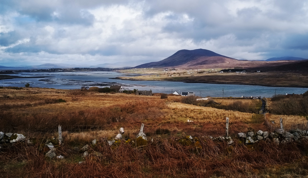
Some years ago I went on a landscape photo course in County Mayo on the West Coast of Ireland. On the first morning of the course we all got up at 5.30 or so and headed out to catch the first rays of dawn. Our course leader brought us to a place with a railing behind which we could just about discern some water and mountains in the distance. We were disappointed that the usual Irish four seasons in every twenty minutes prevented us from seeing the rising sun but about twenty minutes after sunrise we got this scene as the cloud started to break up:
This explains why in Ireland it pays to be patient. The weather really does play a large part in our lives. Anyway, once the sun had arrived twenty minutes late, I could see that we were on a kind of walkway which led far into the distance. I asked the course leader about this and he said that we were on the Great Western Greenway, which he explained was a former railway line which had been converted for use by cyclists and walkers. It extends around two of the three landward sides of Clew Bay going over 40 kilometers in three stages from Westport town to Achill Island at the North West end of the bay. For details see here.
Before going on with the story, I would like to say a few words about Clew Bay. Clew Bay is one of the larger bays on the West Coast of Ireland. Legend has it that there are 365 islands in the bay; one for every day of the year. One of the islands was formerly owned by John Lennon who allowed a hippy commune to be established there. The island was sold after his death.
Some of the islands can be seen in this photo, taken through my hotel’s restaurant window, which caused some reflections.
On the right hand side, far out in the bay, you can see Clare Island (the island with a mountain on it) which once belonged to the ‘pirate queen,’ Granuaile, pronounced ‘graw-neah wail’ in ‘anglophonics’, but anglophones might prefer Grace O Malley, even though the lady in question did not speak English. When she met Queen Elizabeth I, they apparently communicated in Latin.
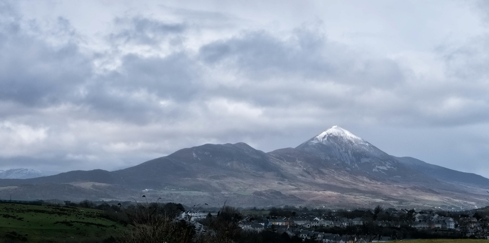
The large mountain, on the left hand side of the photo above, is Croagh Patrick where St Patrick is said to have fasted for 40 days. It is now a place of pilgrimage with a chapel on the summit and on the last Sunday in July (called Reek Sunday) thousands of people from all over Ireland and abroad , some of them barefoot, climb the mountain to attend mass on the summit.
St Patrick was from Wales and so high places held no fear for him. The mountain is a commanding presence on the bay, with great views from the top. It also dominates the town of Westport and the following photo showing the top covered in snow was taken from Westport, while I was there a few weeks ago.
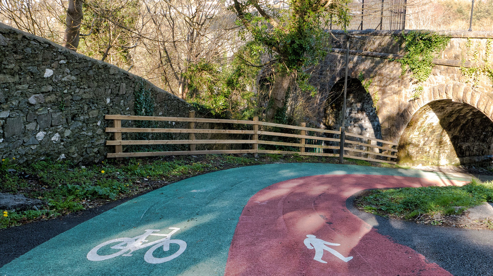
The Western Greenway commences in the town of Westport where it is a colour coded cycle and pedestrian path.
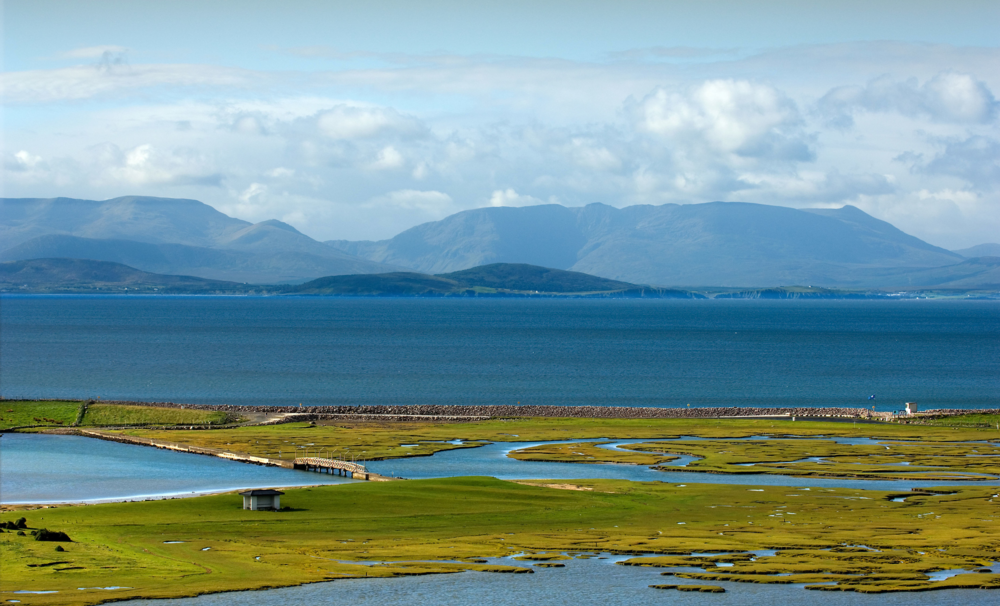
From Westport, the Greenway tracks along the road going north on the old railway line to the town of Newport. It then turns west towards another smaller town called Mulranny. From Mulranny there is a lovely view across the bay to the mountains of South Mayo.
It is at Mullranny that we join the Greenway for a most scenic section of 13 kilometers to Achill Island. I did it in two sections; firstly, from Mulranny to the spot with the railings where I first ‘discovered’ the Greenway in the pre-dawn gloom and back to Mulranny and, secondly, from where the bridge connects Achill Island to the mainland to the same spot with the railings and back again to Achill. I did the first section last year and the second section this year, making a total journey of 26 kilometers.
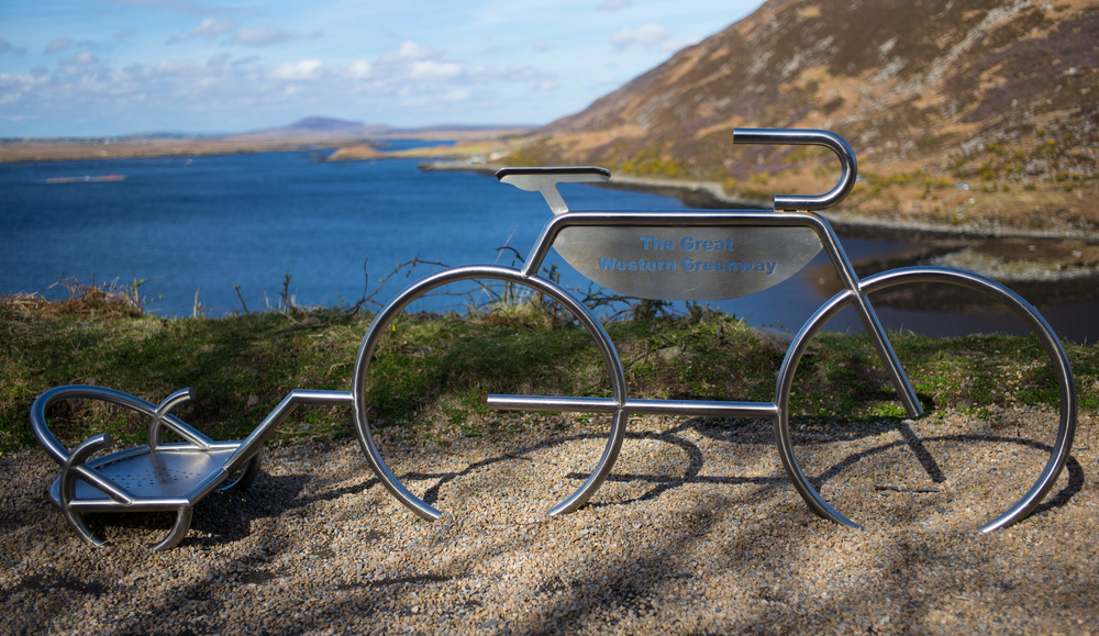
One of the first things I noticed was that most people (about 90%) who travel on the Greenway do so on bicycles. There are bicycle hire outlets at all of the main stopping points where you can pick up or return bicycles. You can also hire little pull-along cycle prams, either for your children or for luggage at those places. There are even bicycle sculptures along the route.
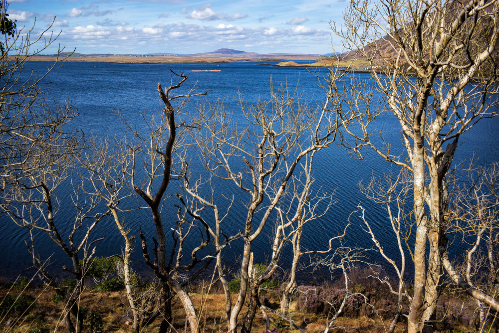
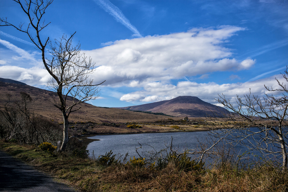
My wife and I did not mind being some of the few walkers on the route and, from my point of view, it was much better for taking photographs, as stopping a bike and pulling out a camera from a bag every time you wish to take a photograph would be a tedious experience. There is plenty to see along the way and just outside Mulranny we hit upon a lake behind some bare trees making for a very pretty picture.
A bit further along we saw the mountains that signal the approach to Achill.
One of the features of the West of Ireland is the way that the trees are all bent towards the East; due to Atlantic winds and storms. Once you reach the West Coast of Ireland there is no other land until you hit the North American East Coast and so the weather is, to say the least, variable. On a fine day, you can, of course, see a lot of jet trails in the sky. Over nine tenths of North Atlantic air traffic goes through Irish air space.
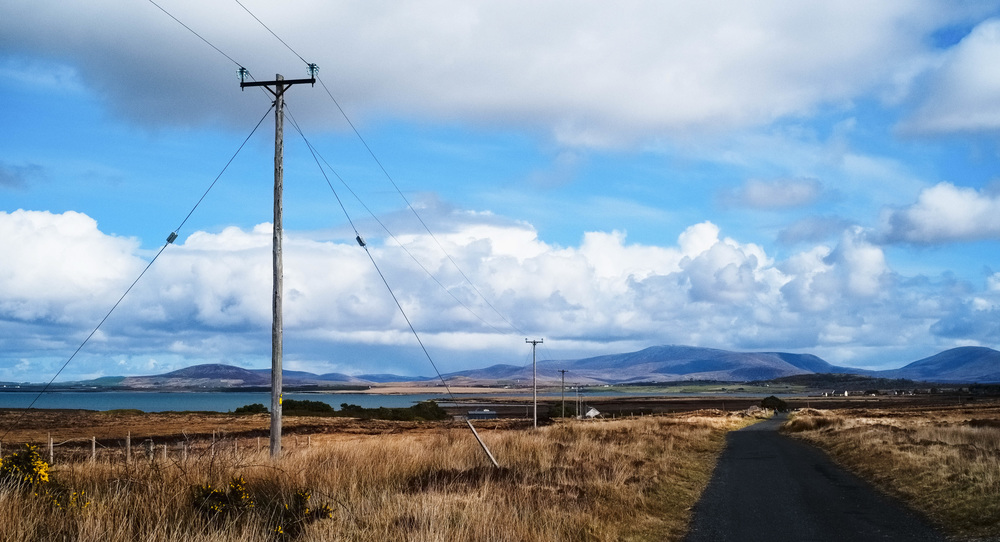
For this year’s walk we started at the bridge at Achill Sound and walked back towards Mulranny. There were obvious signs of the former railway line such as these power lines and poles, which lead the eye into the distance.
At this point, the Greenway is fairly flat and it resembles a gravel path tracking both the road and the location of the former railway line. There is beautiful scenery to be seen everywhere but sometimes it pays to look up.
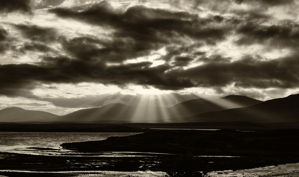
The West of Ireland is famous for its ‘big skies’, immortalised by the painter Paul Henry.
Here is an example of such big skies.
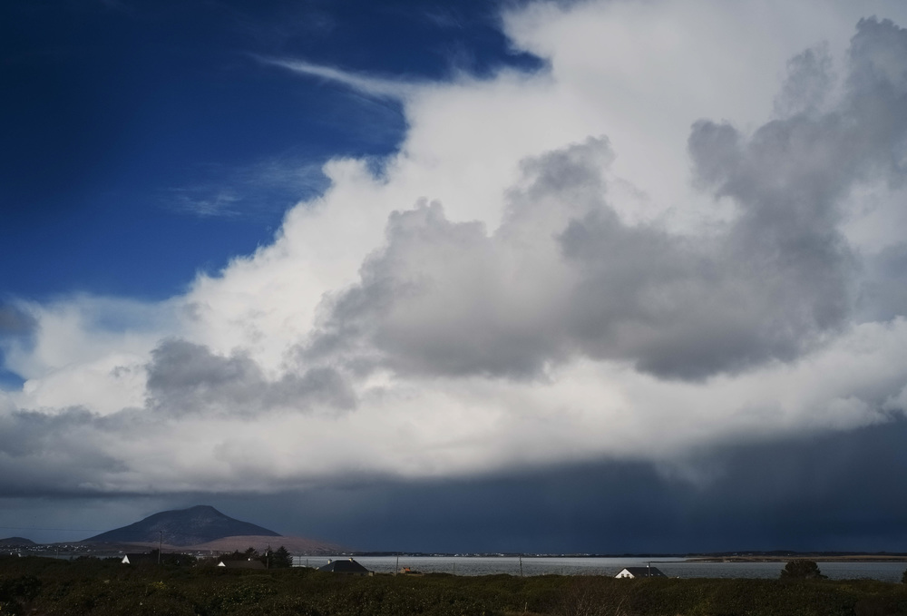
These striking clouds are, of course, aided and abetted by the Atlantic winds and the four seasons in every twenty minutes. At the bottom you can see a storm passing, while on top there are clear blue skies, a common sight in that part of the world.
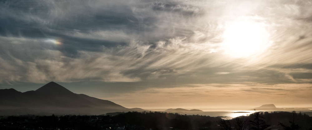
On the way back to Achill you can get a good view of the mountains on Achill which appear to be blue in the distance just like the mountains in Paul Henry’s paintings. This is just another element in the unique colour palette of the West of Ireland, which is at its best after rainstorms.
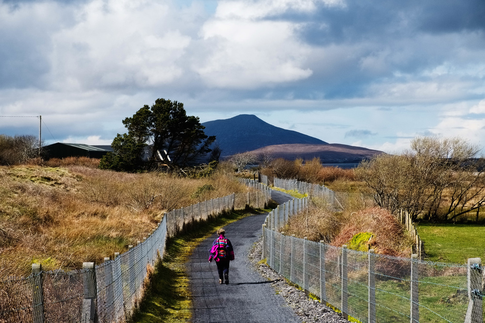
In this photo you can clearly see the structure of the Greenway as it wends its way through the countryside. You can also see my wife wearing highly coloured hiking gear in case I lose track of her while taking ‘too many’ photos.
To finish off this article I want to show some photos of Achill Island, which would be worthy of an article in itself.
The first photo is of Achill Sound which is the main piece of water between Achill and the mainland. This photo also illustrates the colour palette of the West of Ireland with its greens, browns and blues.
The photo above was taken from a walk called the Granuaile Loop which we soon abandoned as it was ‘built’ over a moving bog (in the correct Irish definition of the word). We reckoned it would take about three months without rain to dry it out.
A bit further down the road we came to a tower which is reputed to have belonged to Granuaile.
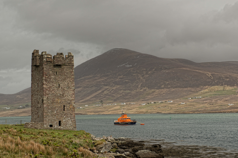
You can take a boat from here across to Clare Island where Granuaile had her main dwelling.
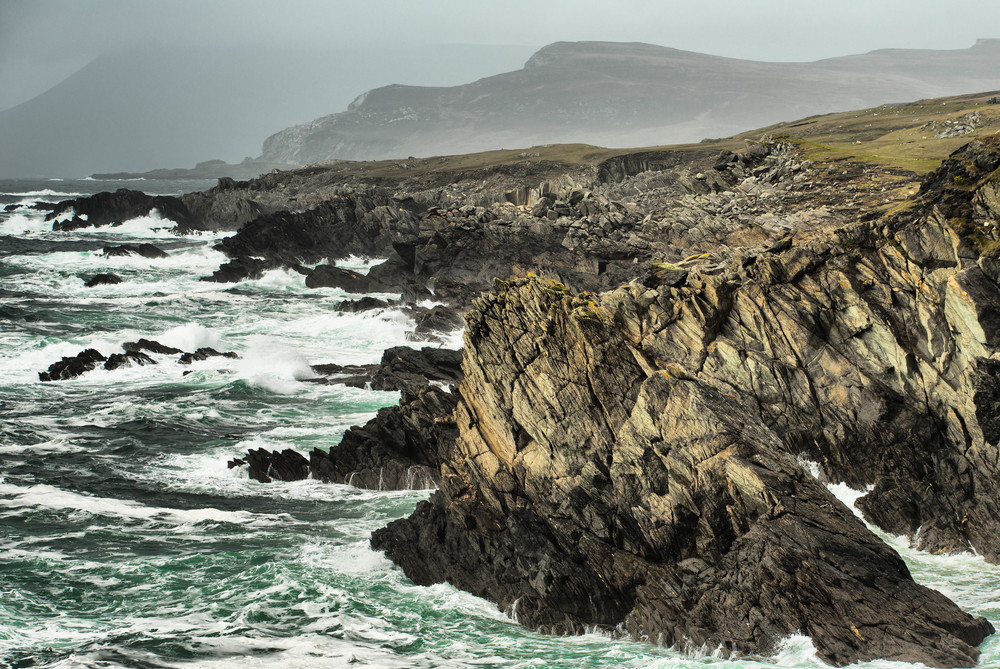
Further along the coast of the island you come to a series of inlets which look spectacular in stormy weather. The photo here is a panorama of a series on inlets on Achill.
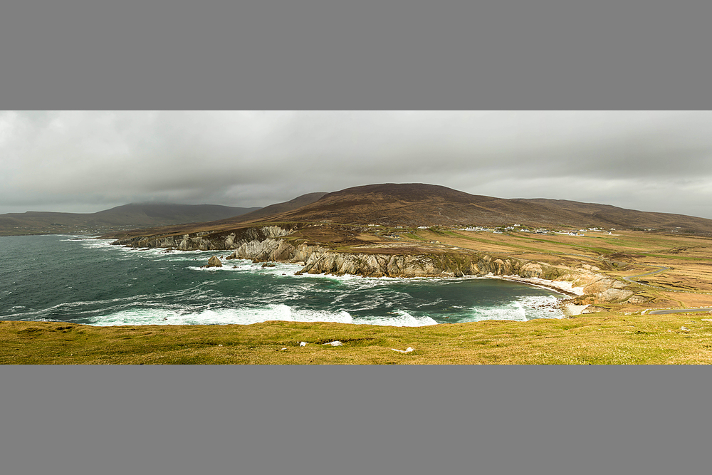
This was taken handheld in portrait view without a tripod or a panoramic head, relying on Photoshop to stitch up the 8 or 9 photos in the sequence. The main techniques are to use manual focus and manual exposure and to move smoothly from left to right or vice versa, leaving some overlap between shots as you go along.
Also on the island, you can see magnificent sea cliffs, such as these at Keel.
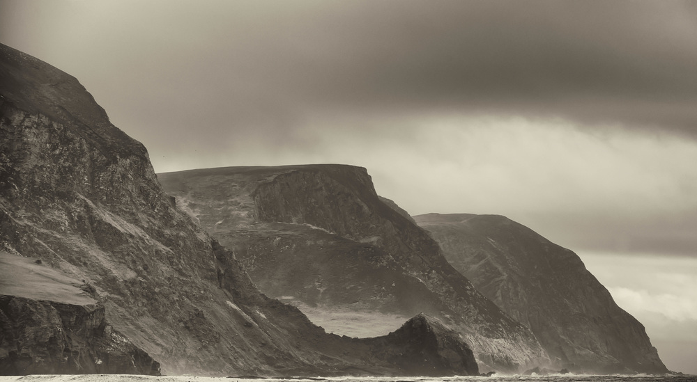
These are not the highest cliffs on the island. Further along the sea cliffs at Croaghaun are the third highest in Europe.
Finally, we ended up where the road runs out at Keem Bay. The next road to the west is in North America. Achill used to have a shark fishing industry at one time. This was for large placid basking sharks who were two or three times as big as the boats of the fishermen. They were caught for their liver oil. This charming old video shows Achill as it was in the 1950s and some of the shark and other fishing activities which took place there.
When I got to Keem Bay there was no sign of the former shark fishing activities. All I could see were a lot of Russian guys with spear guns and rib boats but I did not feel tempted to ask them what they were doing. What I did find was this young seal.
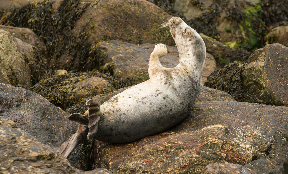
The young seal had been stranded on the rocks between tides and it would not have been possible to return him to the water without specialist knowledge or equipment. I hope that he got away when the tide eventually came in.
Technical notes and a competition
The numbered photos in this article were shot on the following cameras Nikon D2Xs, Nikon D800E, Lumix LX 100, Leica M240 and Fujifilm X-Pro 2. Can you guess which camera took each of the photos? There are some clues in the text above. A special blessing from St Patrick will be awarded to the provider of the first successful answer. If there is no correct answer, I will award the blessing to a charity of my choice.
- Subscribe to Macfilos for free updates on articles as they are published. Read more here
- Want to make a comment on this article but having problems? Please read this
Thank you William – Super photos and an excellent read. I’m passing on the link to my sister Sylvia in Illinois USA – she loves Ireland. Regards from dunk
Actually it was a flight from Glasgow…….it would be some trick taking off and landing in Dunoon.
Thank you for the effort in making this available. I will probably never make it back to Ireland and enjoyed the photos. One flight, all those years ago, when young and in the navy, my flight from Dunoon, Scotland to U.S.A made a stopover in Dublin. They had overbooked the flight from Dublin to U.S.A. and a beautiful young Irish lass came aboard the plane and offered anyone who would give up their seat a free night in Dublin…… all expenses paid by the airline. I still regret the choice of not giving up my seat.
Thanks Stephen
The West Coast all the way from Cork/Kerry to Donegal is all well worth visiting. The character of the landscape changes as you go along. One of the best ways of finding what is worth seeing is to look at this website http://www.wildatlanticway.com/home/ and to follow the Wild Atlantic Way signs when you get to the interesting areas. My article just covers one small section of this route.
William
This is one of the areas of Ireland that I have yet to visit William.
Your excellent travelogue and the wonderful pictures that you have made, are making me inclined to do it this year… We are going to a wedding in Dingle, and it is but a short hop up to Mayo from there.
Previously the furthest north along the west coast we had been was, Doolin and the Burren, which is pretty wild too.
As to the prize, I have no idea which cameras you used, though I suspect that the newest pictures employed your brandy new X-Pro 2!
Dear John Greenfeldt
Thanks for your prompt reaction to my article. If you come to Ireland on your next visit to Europe, you will find that there are no strangers here, just friends you have not yet met.
I hesitate to pronounce in public about image quality (IQ) as this is something that largely only interests photographers and is often a matter for subjective judgement. Most non photographers (although almost everybody with a smartphone is a photographer nowadays) look for some kind of appealing visual quality in an image; let’s call it VQ. In the case of landscapes, the credit for this VQ is largely due to God, nature, the weather and the photographer’s composition etc and not the camera. As for IQ, many photographers confuse this with sharpness or perceived sharpness, which could be regarded as objective standards. There are, however, other qualities involved such as tonality and colour rendition which are more subjective in their nature. What would appeal to one person might not appeal to another.
The following is my subjective judgement of IQ of the cameras used for my article, all of which have exceedingly high IQ in my judgement. Relatively ranked from top to bottom my preference would be in this order; Leica M240, Nikon D800E, Fujifilm X-Pro 2, Lumix LX 100, Nikon D2Xs, but as Wellington said about Waterloo ‘it was the nearest run thing you ever saw in your life’. The Leica M240 probably wins out because of the quality of the Leica lenses which, to my eyes, bring a quality not to be found in other makes, except perhaps some older Zeiss lenses. The Fujifilm X-Pro 2 has by far the best colour and I have used Leica lenses on most of the X-Pro 2 photos above but they don’t work quite as well as they do on the camera for which they were designed. As I said, the margins remain very close. The other factors which are significant to me include weight and handling and the Fujifilm X-Pro 2 would also rank very highly on those characteristics. Its top plate design is as close to perfect as I have seen on any camera. it is the camera I use most at present. While I rank the Nikon D800E higher, I don’t use it very much because of its size and weight.
William
Some really excellent work there, William, and congratulations on an entertaining travelog. It makes us want to visit Ireland on our next visit to Europe—it’s overdue. Without giving away any secrets, particularly since you mention five wildly different cameras, how would you rate them in terms of image quality?