
The village of Vallouise (1200 metres above sea level) was our family summer holiday haunt for many years. Apart from hiking and mountaineering, the area provides many outdoor activities such as kayaking, rafting, horse-riding on mountains tracks, canyoning in mountains rivers and gorges and plenty of via ferratas with spectacular zip-lines within ten miles from the villages at most. It benefits from a mostly sunny climate with cool nights and hot days.
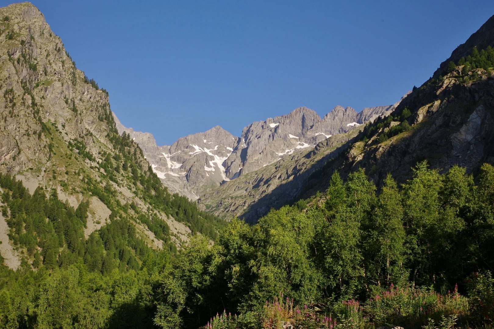
The village is situated in the southern Alps in the Ecrins national park which was created in 1973. It is the second French mountaineering centre after Chamonix. The valley boasts many mountain peaks with heights between 3500 and 4102 metres, the highest summit in the area. The British and American alpinists Edward Whymper and William Coolidge were the first to climb some iconic peaks of the area.
The name of the village has changed over the centuries.
In 739 it was named Vallis Gerentonica – the valley of the rocks. In the thirteenth century, the name changed to Vallis Putas – the evil valley — as it was the refuge of the Vaudois, a protestant Italian religious order founded by Peter Waldo. Protestants were then persecuted in Catholic France.
At the end of the fifteenth century it became Vallis Loyssa. The name was chosen as a tribute to the French king Louis XI who momentarily put an end to the religious persecutions of the Vaudois.
The village
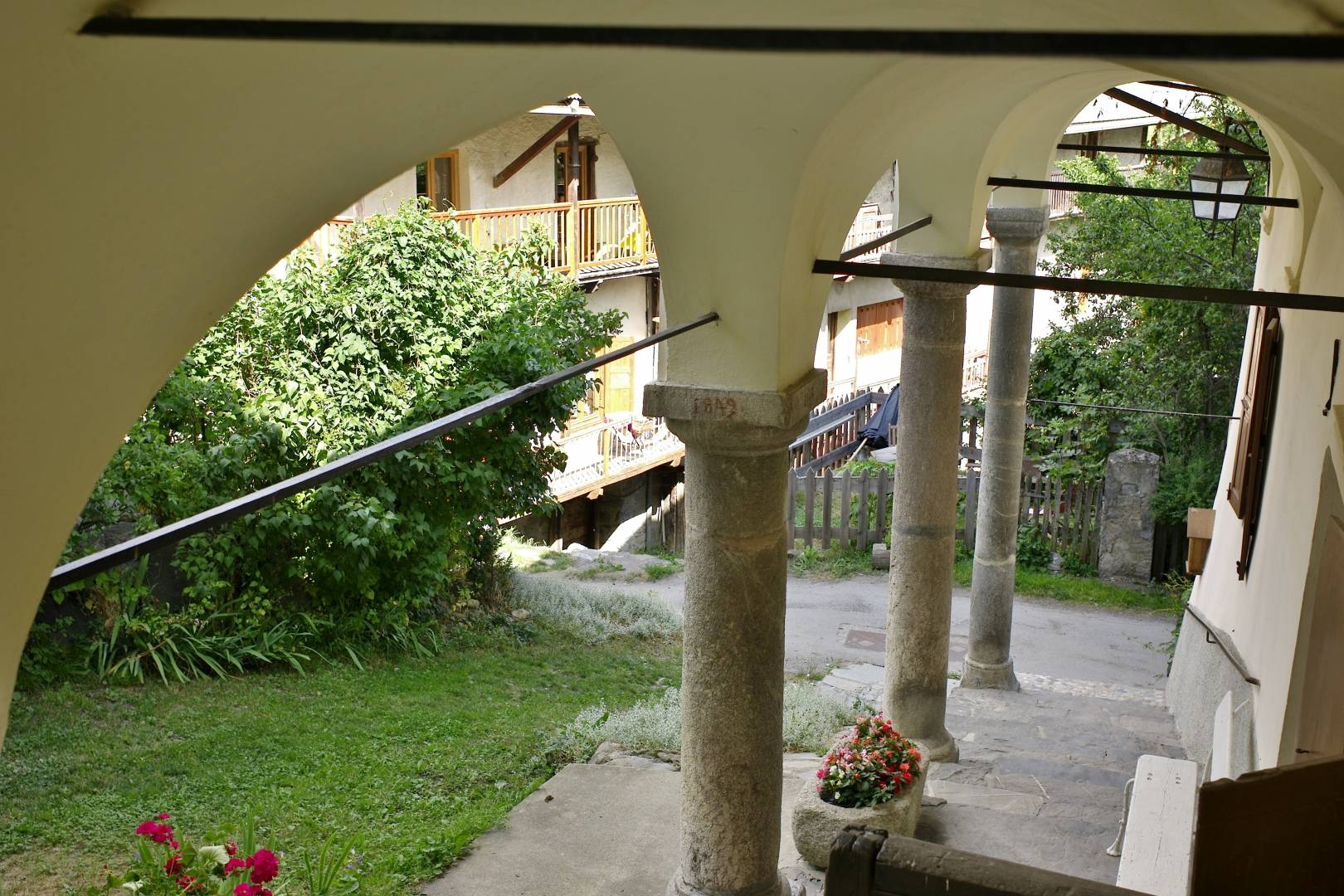
The village is a typical mountain habitation with former farms featuring vault and arches. They are usually built on three levels. The ground floor was usually used as a barn area for cattle in winter. The family normally lived above the barn on the first floor. The second one was used to store hay to feed the cattle in winter. The cattle spend summer on higher ground and are kept in stables in winter.
Click on images to enlarge
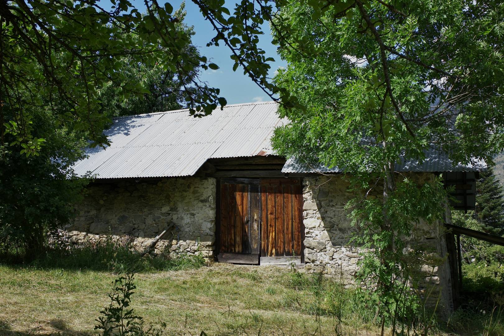
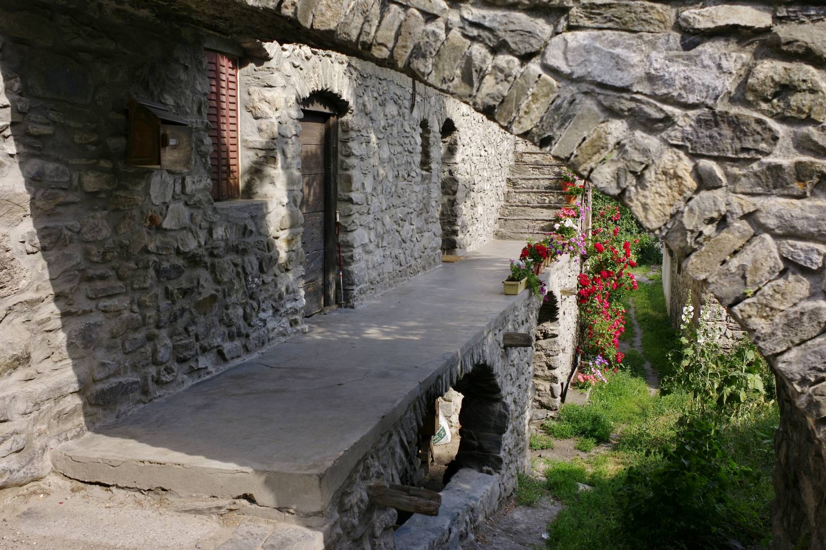
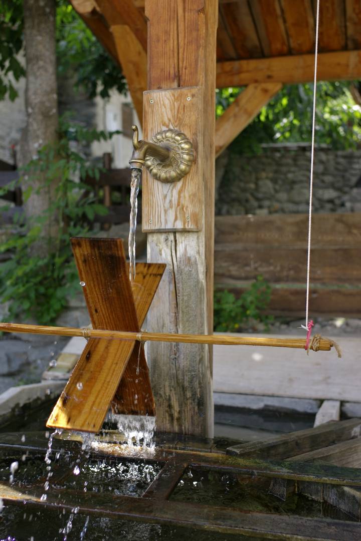
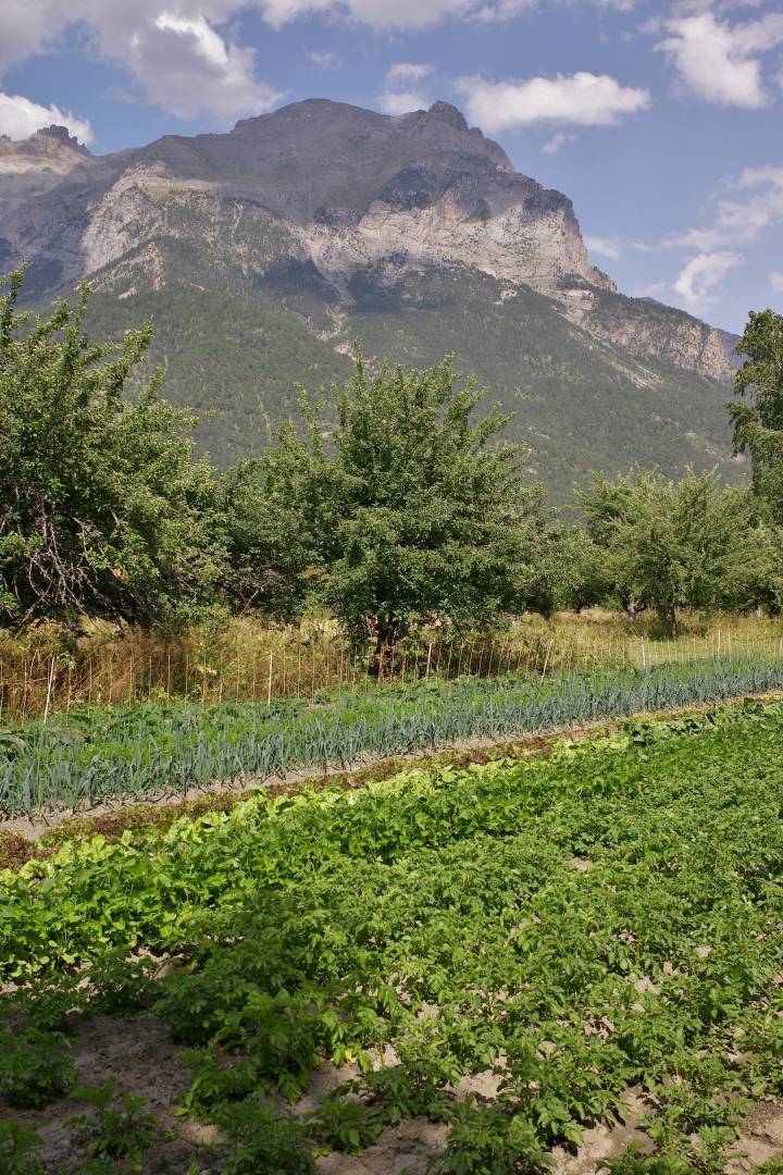
You also find many water fountains in the village, usually made of wood. The narrow strip of flat land in the village is used to grow vegetables and fruits during the short and hot summer season while some parts remain uncultivated to provide cattle with hay in winter. The flatlands turn into cross-country ski trails in winter.
The shepherd hut in Jas Lacroix
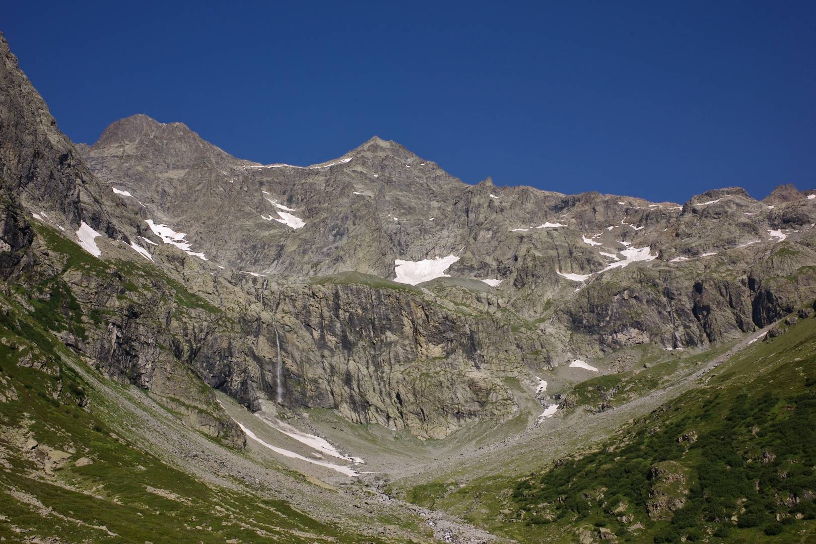
This walk starts at the end of the road leading to the mountain hut up towards Les Bans, a 3669 metres peak. A few hundred yards after the carpark a path forks left and allows you to reach the hut. The path overlooks a mountain river. Once you hear the flight of horseflies you know you are close to the shepherd’s hut as sheep and cows are still grazing at this altitude.
Reaching the hut is not the most exciting part of the path. You have to pass the hut, cross a mountain river on a few wooden planks and go up a steep slope on a zigzag path.
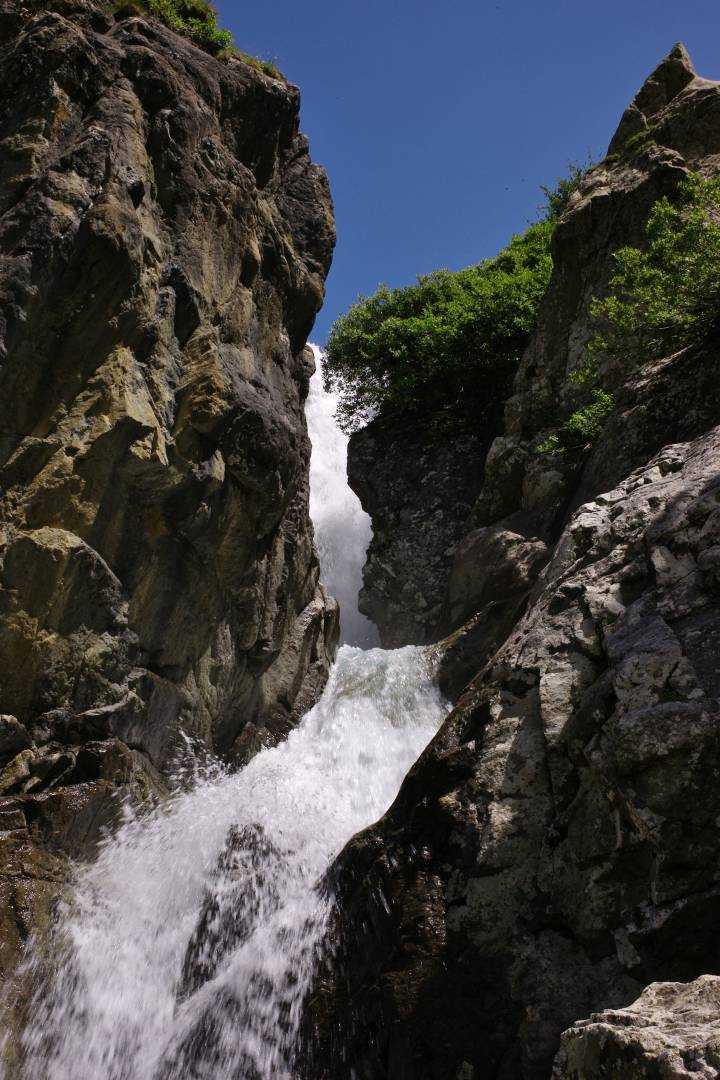
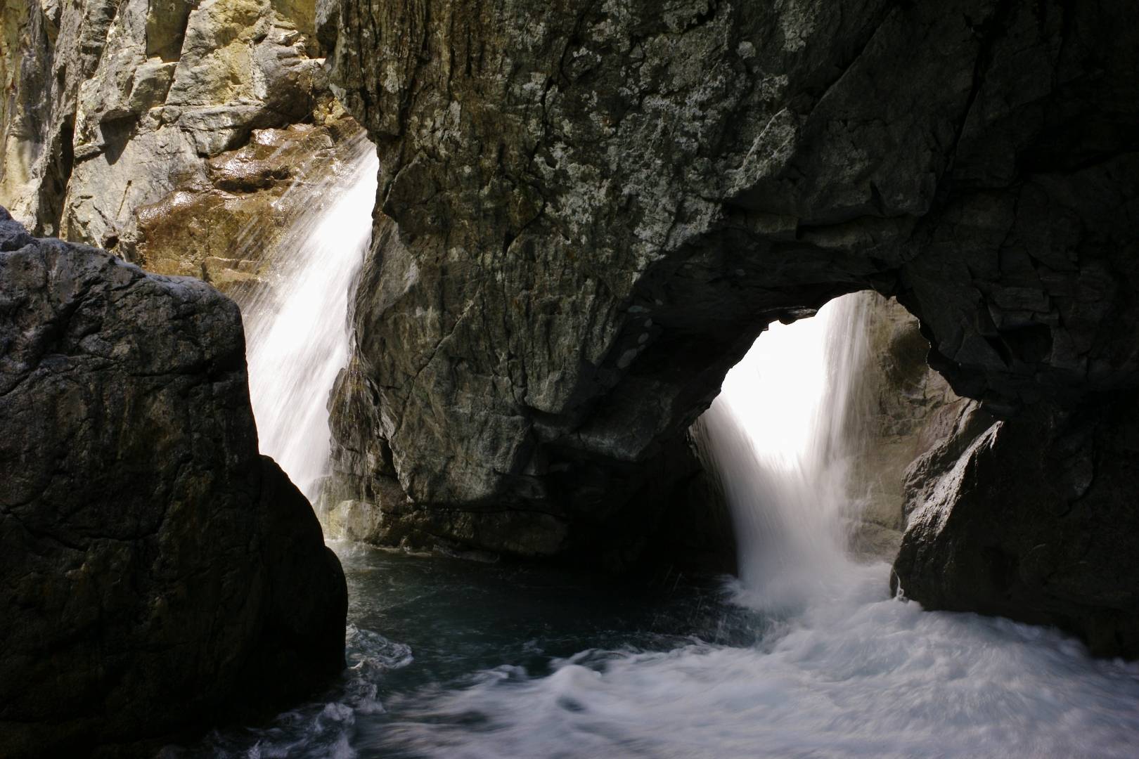
Then comes the reward. A huge glacial cirque awaits you with waterfalls and streams all over the place. The bottom of the cirque looks like a relatively flat playground according to mountain standards. If you are not too tired after a three-hour ascent, you can reach a mountain pass. Unfortunately, the path to the upper end is made of tiny black shale and snow patches which makes it very slippery and dangerous if you’re not an experienced walker.
Pelvoux Mountain hut
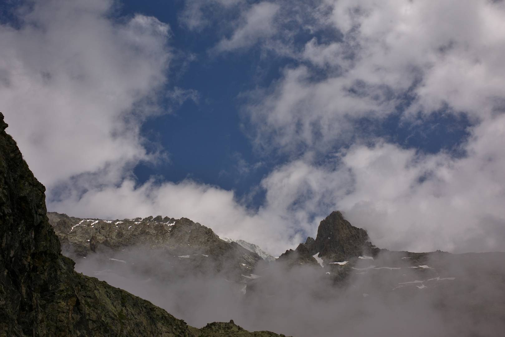
This one is a strenuous walk, climbing over 1,200 metres. You need to start early from Ailefroide. In the summer, a start around 5.30 am or 6 am is essential. In the lower part of the path, you are bound, literally, to stumble into chamois and marmots.
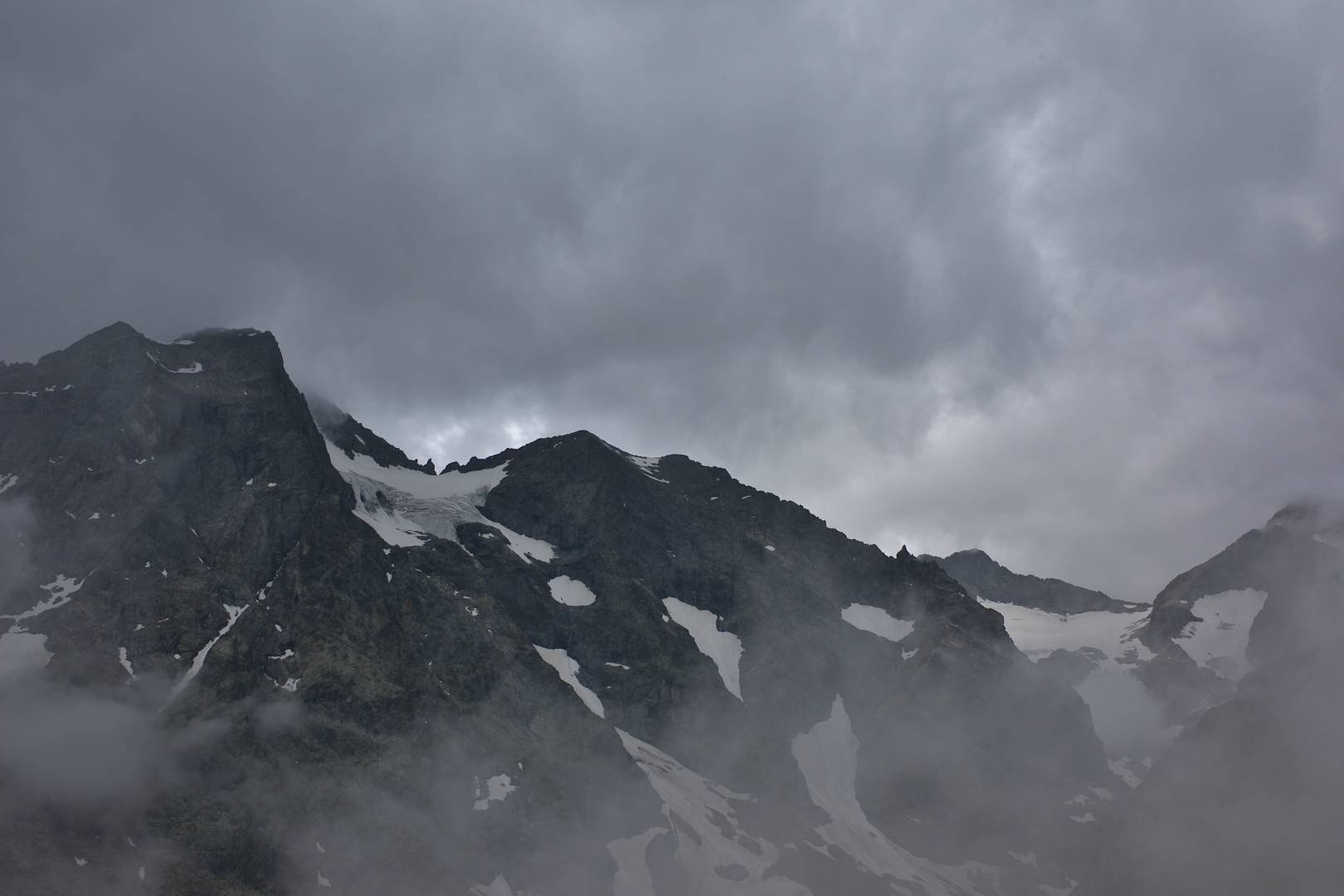
Before the steepest part of the walk begins there’s a spring where you can refill your flask. The path rises through a larch wood and then you’re on open ground. One of the last times I went up there was with my son. The weather was rainy and foggy. Fortunately, the rocky ledges are well marked, which makes thing easy in misty weather. Going up in such conditions is quite eerie as the surrounding summits appear and disappear in shrouds of mist or clouds.
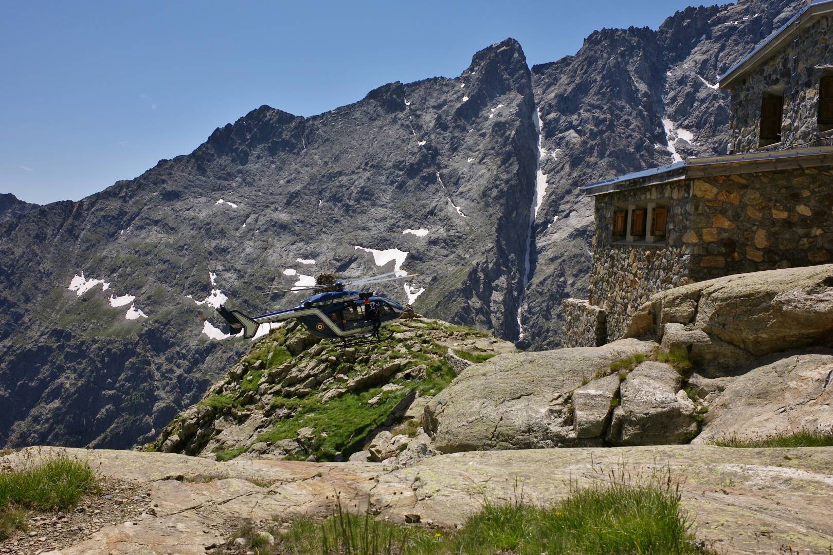
On a sunny day, the sound of the mountain rescue helicopter can be heard daily. The landing platform is a semi-circle with a dry stone wall. Unfortunately with global warming, the thawing permafrost makes it dangerous to reach the mythical summit of mount Pelvoux as big rocks break away from the mountains. I’ve been there dozens of times and every time the mountain rescue helicopter was there to pick up wounded mountain climbers. My son did try a winter ascent but had to give up as the ice was not hard enough in ice gullies.
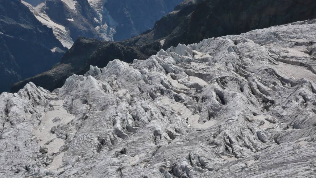
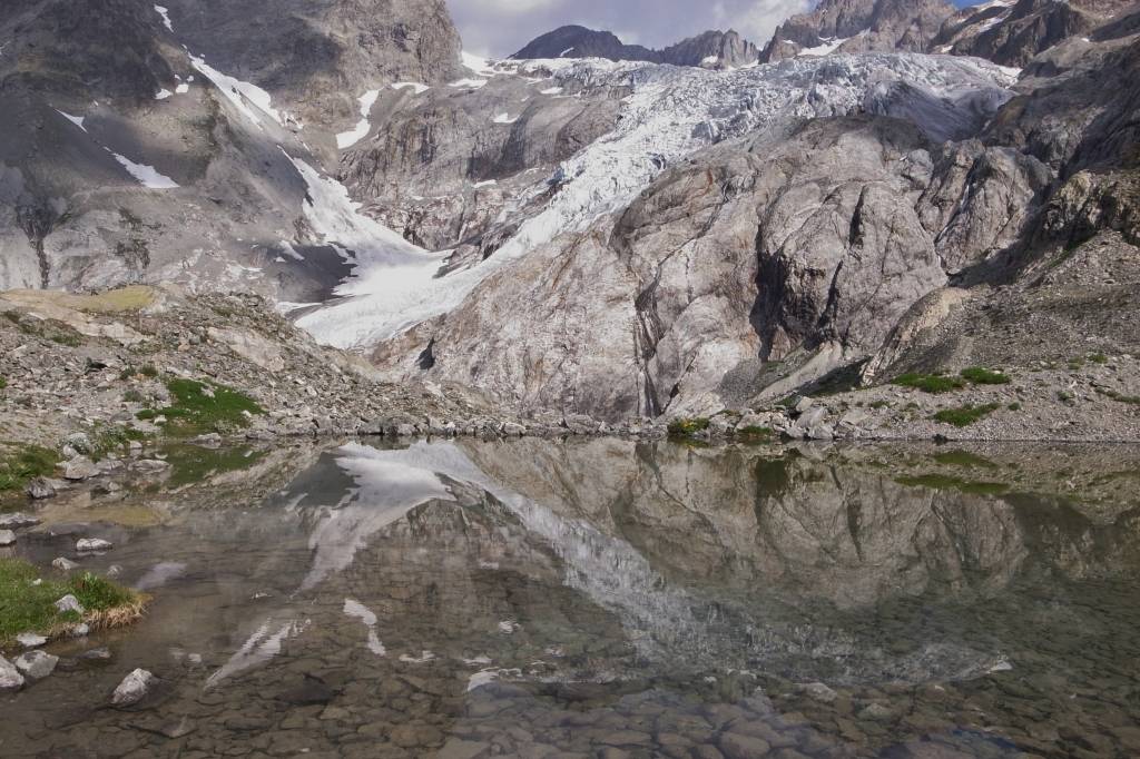
Glacier Blanc and la Barre des Ecrins
Le Glacier Blanc or white glacier is one of my favourite mountain hikes. I must have been there on my father’s back when I was hardly four years old. The glacier has receded by five hundred metres over the past 56 years. The lake before reaching the glacier is beautiful, with the mouth of the glacier reflecting in the water.
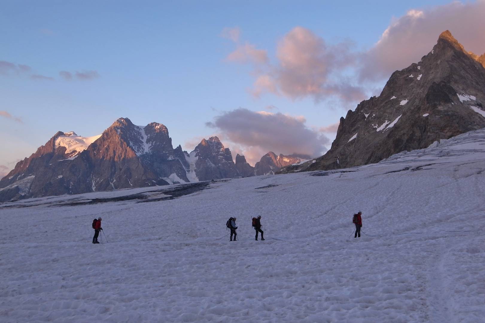
The last hike in the mountains
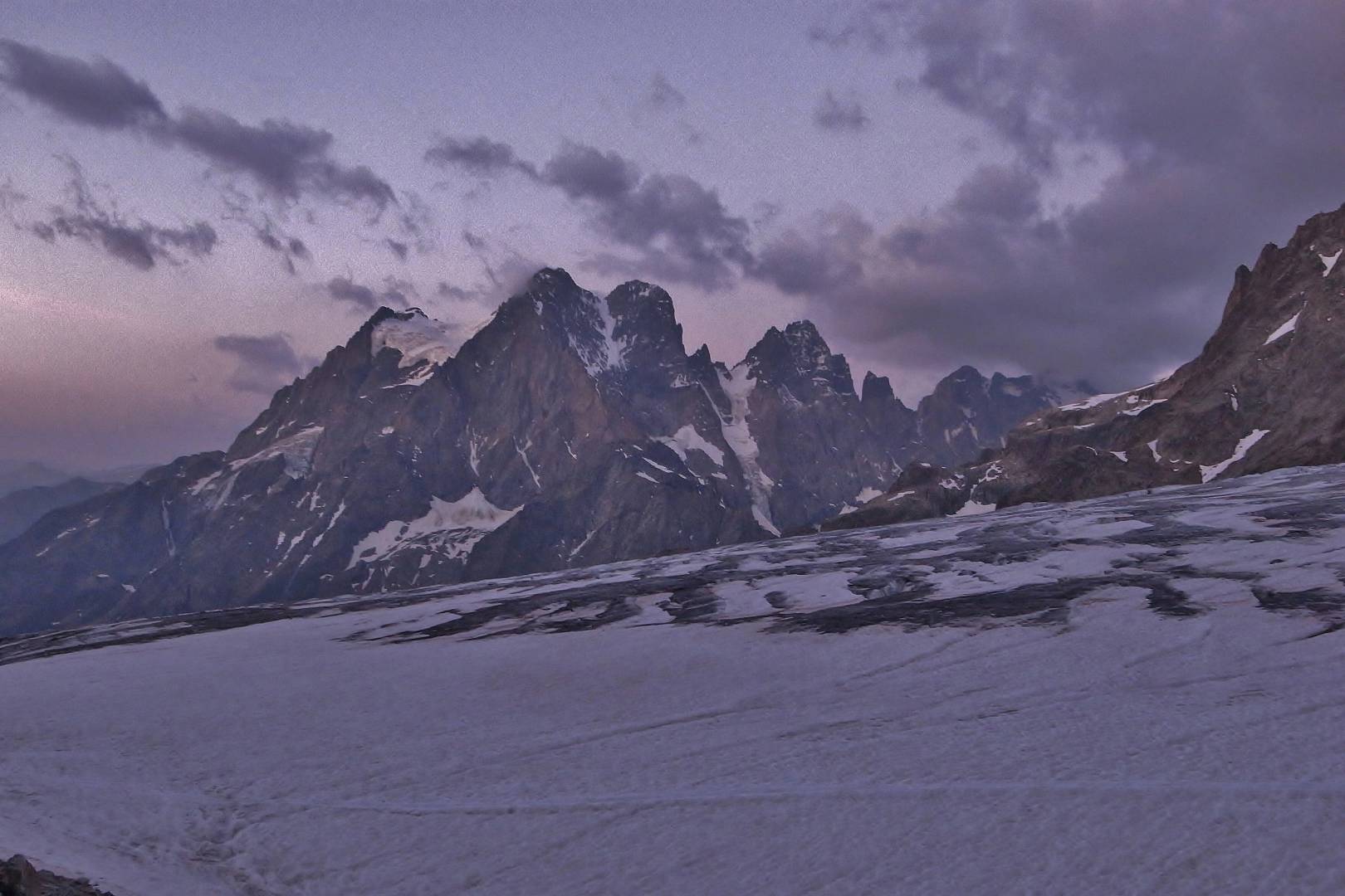
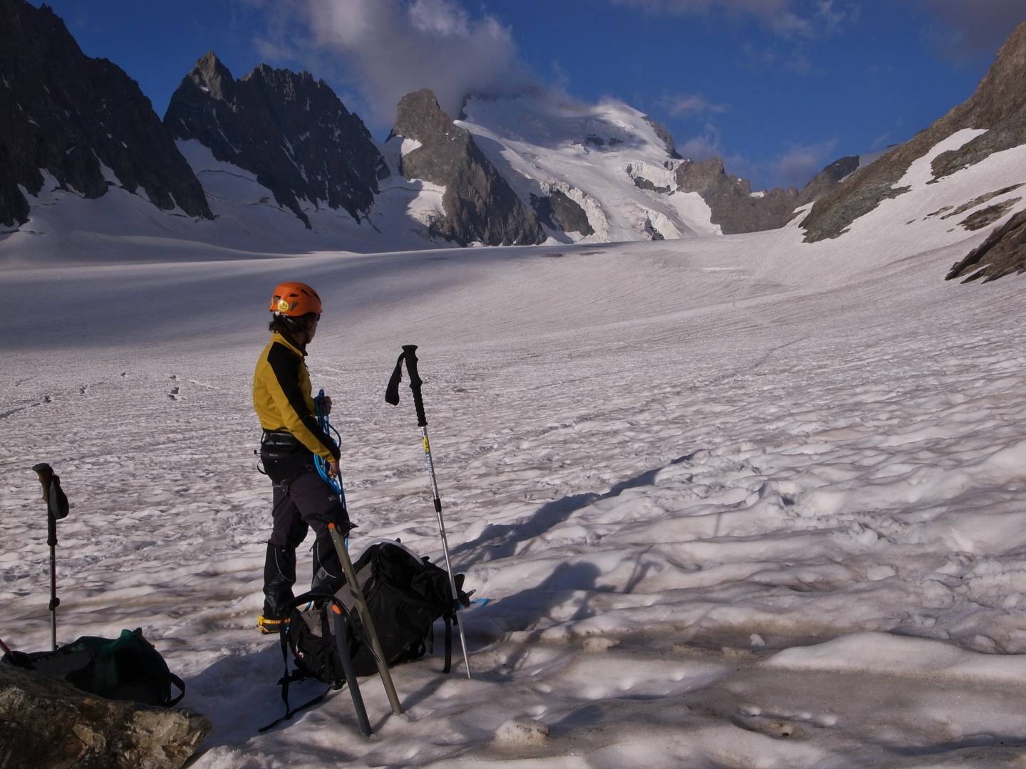
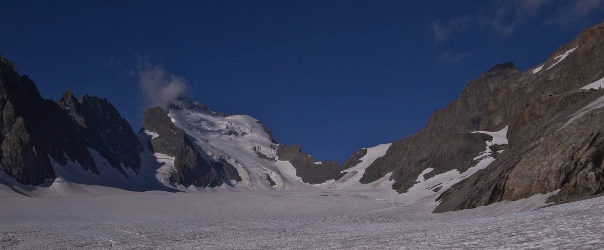
Some ten years ago my son and I planned a hike to the Ecrins mountain pass, a small rocky notch at the end of the glacier under la Barre des Ecrins. My wife dropped us just after midnight. We started in the dead of a moonless night with just our headlamps to light our way. We reached the glacier around 5 am while the sun was almost rising.
The view was absolutely breathtaking, with its purple skies and still dark mountains. There was nary a sound apart from the shuffle of our feet and our breathing. Sometime around 6 am we spotted the first rope party on the glacier. We set foot on the glacier at about thirty minutes later.
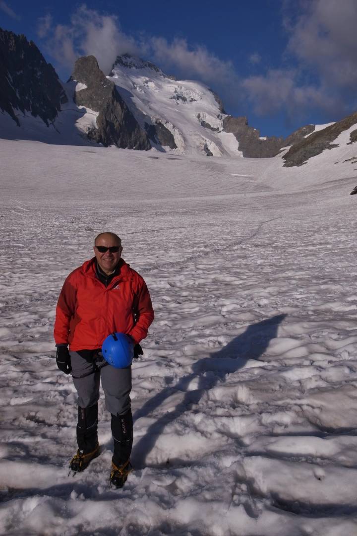
Time for a couple of snapshots of my son and me. We walked for another couple of hours on the glaciers but never reached the pass as the temperature was rising. The snow bridges over crevasses became fragile and continuing would have been too dangerous We didn’t fancy ending our lives at the bottom of a crevasse. By the time we reached our starting point after twelve hours on the hoof, we had covered almost a 3000-metre difference in height. I definitely think I would not be able to do it now.
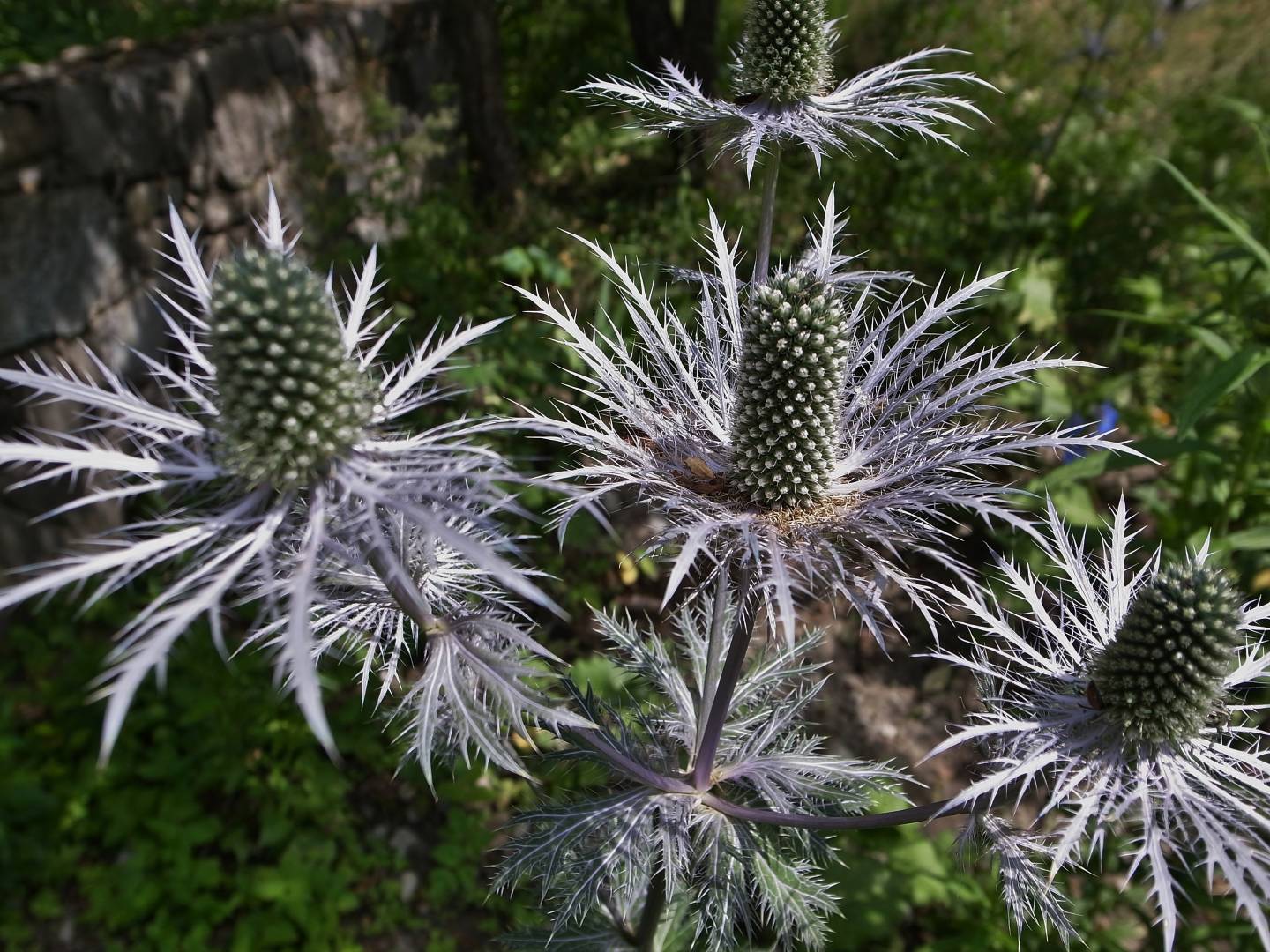
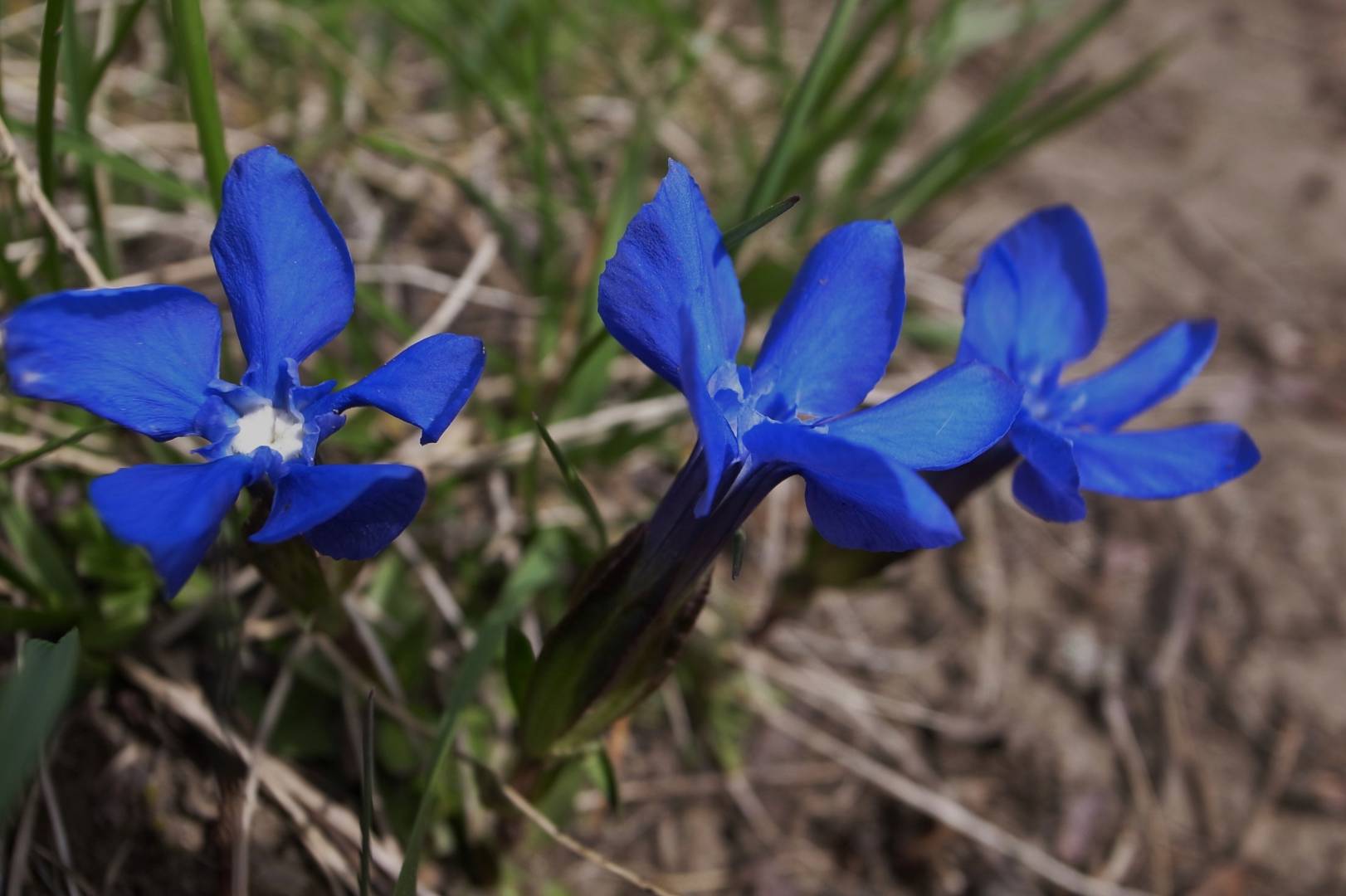
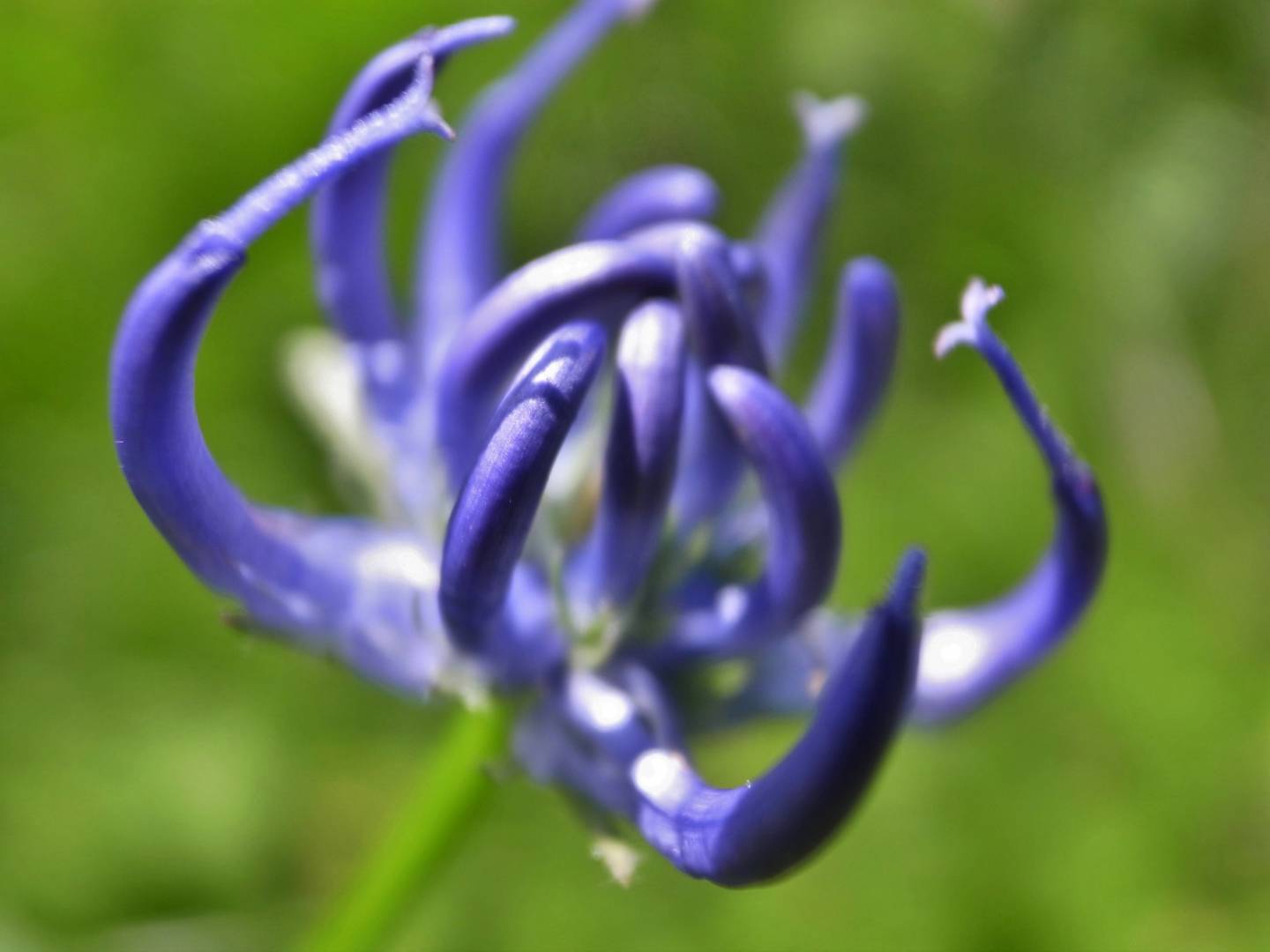
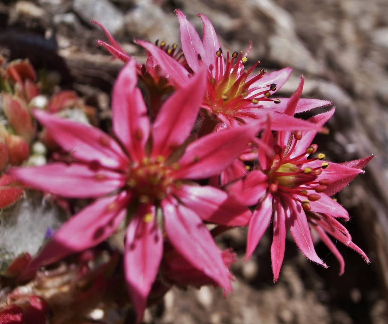
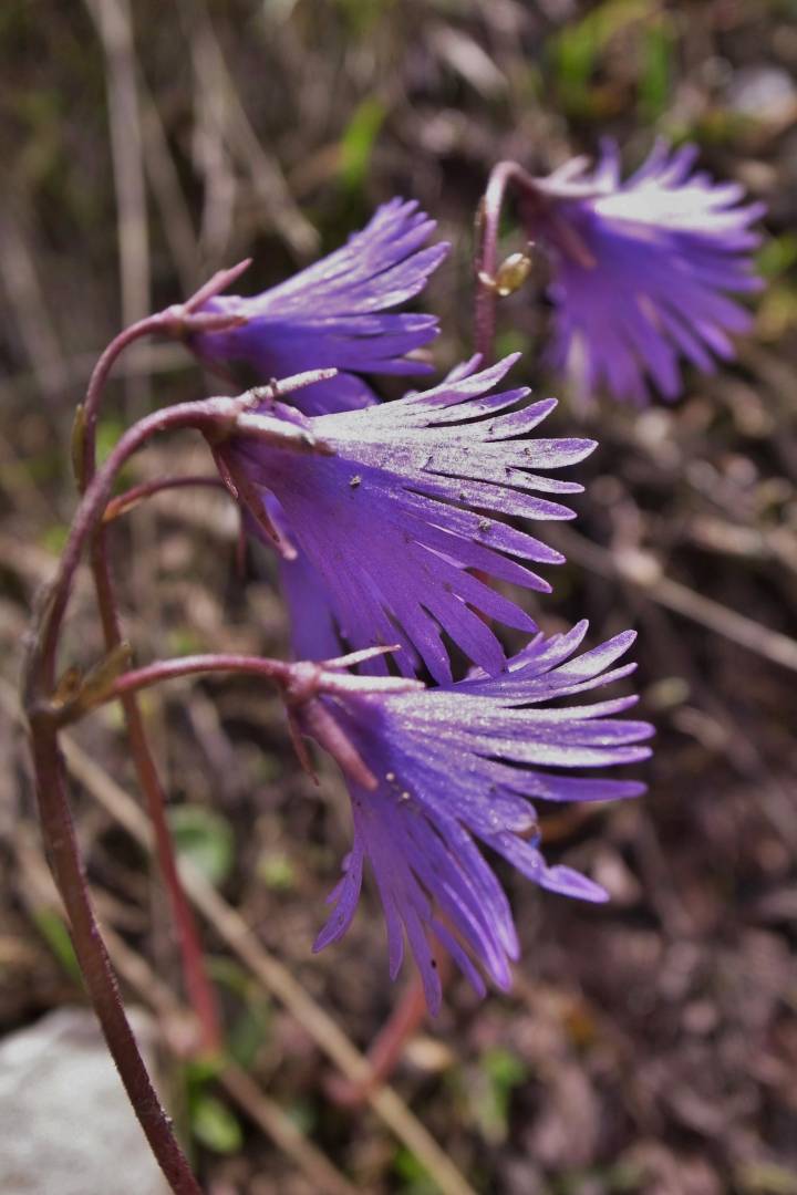
Flowers
Apart from the ever-changing landscapes, one of my greatest pleasures is to look at and take pictures of flowers. The Ecrins National Park boasts many endemic flower species that can be found only in the Alpine regions.
The first image of the article was taken with the Leica C-Lux 2, my first-ever digital camera. Most images of hikes were taken with my now-departed M8 and the Elmarit 28mm ASPH. I did miss a slightly wider field of view with the 1.33 crop factor of the M8, but I loved the colours the camera produced. The images of my last hike and flowers were taken with the Ricoh GRD 3. This small camera, despite its tiny sensor, is perfect when mountaineering. It’s light and resists the cold if you are careful. I’ve passed it over to my son. He still uses it almost every week when he goes mountaineering. So far it is still a reliable tool.
looks alluring. Enjoy it when you get it
Rumoured spec from Fujirumors is
“IBIS
Body size is bigger than X-T3
16bit RAW
New battery
ISO 64
Fully articulating flippy screen like the Panasonic Lumix-S1H
6K video at 60p, 4K video at 60p 2K video at 120p”
IBIS and the more powerful battery are big first attractions. I don’t know the pixel count but would imagine 26MB.
What will the XT 4 like? Amazing number of pixels?
Your love for the area shines in your images.
Re Fuji upgrades, I am still using my X T2 and X T20. My plan is however to order an X T4 on the day it is announced (late Feb) and then to run my X T2 as the second camera, selling the X T20 to help finance the deal. I never considered the X Pro3 since it does not suit me. I have a weaker right eye which means that if I use my strong left eye in the viewfinder on the left of the X Pro3 then my nose impinges uncomfortably right in the middle of the back of the camera. Its my fault not the X Pro3’s!
Thanks for your kind comment. This part of the national park is truly an amazing location. The villages are a blessing regarding architecture and the surrounding mountains are pure beauty. I’ve been all over the park within a 40 years span and this is one of my two favourite valleys. It provides all kinds of walks from the really strenuous ones which take at least a 10-12 hours’ efforts to relatively mild ones which can be covered in 3 or hours. Wish I had an ND filter for the water shots but I presume I’ll be returning to some of these places with ND filters. Did you upgrade your fuji gear to the new x pro 3 or the XT 3?
Your article and images are a delight. After the tectonic event of 31 Jan 2020 in Britain, how splendid to enjoy a calm moment to appreciate the awe inspiring beauty of the Ecrins National Park. Your images of the high mountain passes and peaks are great and I love the way you photograph water particularly the waterfalls.The flower pictures too are excellent, as indeed the detail and architectural ones. Once again, you prove your skills are as good in colour as in mono!
Thank you Jean.
Thanks John for your kind comment. You really don’t need oxygen at those heights. You can get flight over these mountains provided you befriend the mountain rescue team otherwise flying over the park is totally forbidden.
Remind me not to take a hike with you unless I have an owygen tank and 2 Sherpa guides to carry me! WOW do those photos pop! Have you passed thru that area to see any effects from Climate change? That is a tremendous area for famil get aways. Thanks. Be safe and healthy in your next trip.
Hello Jean. The moody tonality of the first image in the Pelvoux Mountain Hut section strikes a chord for me. Ominous foreboding, and the mist or cloud in the foreground adds to it.
Thanks for your comment Wayne. Hiking in those places is much easier than the Himalayas as you’re never short of breath. I remember hiking in Bhutan and it was much more difficult to breathe once you’d reached the 4000 metres. Pelvoux mountain hut is worth the climb on a cloudy day as the weather usually clears up in the afternoon and you have the clouds drifting over the mountain peaks.
Hi Jean, I really enjoy your articles.
This one was not black and white in impact – my humour knows no bounds.
Your article brings back fond memories of my adventurous youth that was more risky than I would think sane now.
Please keep up the contributions to toward the success of this blog!
Hi, I also enjoyed no text on your images😅.
Sorry Mike, I was under the influence of chemicals and am not responsible for my comments.
Thanks Brian. Hiking’s not that dangerous though.
Thank you, Jean, for a glimpse in pictures and words of an – to me – unknown corner of France. Pardon my ignorance, but what are “via ferratas with spectacular zip-lines”?
I would just add that I really appreciate your way if dialoguing with those who comment.
Thanks John for your kind comment. As to via ferratas they originally come from Italy and you have plenty of them in the Dolomites and the Italian side of the Alps. Basically they are fully equipped climbing sites. In the difficult parts you get iron step ladders or any extra security required to overcome a climbing diificulties. A zip line is a long iron cable usually over a highland river or over gorges. You attach your harness and a very short mountain rope to the cable and with a rolling system you let yourself go into the void below you and reach the other side. I don’t know if my explanation is clear but they usually are good fun and quite spectacular in some cases.
Very clear, Jean. Thank you.
This sounds like my perfect holiday – long walks in unique terrain. I almost wish I had been there with you, more so to experience the unique part of passing over the glacier – that is something I would like to experience.
You have managed down the years to capture some wonderful images of the area, and the three cameras have served you well. I cannot wait to hear more of your photographic adventures in these wonderful places.
Thanks Dave for your kind comment. This area is one of the most beautiful in the Alps. Apart from one mountain hike on glacier the most beautiful walks are not the most strenuous ones and provide plenty of photo opportunities with larch woods, highland rivers and flowers and alpine animals if you have a telephoto lens (too heavy to carry for me). I do encourage you to go in early summer ( mid-June early July) to capture nature in full bloom.
Thanks Kevin. The GRD3 was a great help as it was so light to carry. All the images of the hike were taken between 5 and 7 am. I’m still pretty amazed by the speed of light in summer.
Very enjoyable Jean, thanks. That of the mountains in the early morning purple light is beautiful.
Thanks David. It’s not that tiring as long as you take your time and take time to make images. You know that you’re bound to stumble on something interesting you’ll record on your sd card. There are a few stellar hikes I’d like to do again after I retire next year (with the X2 + a nd filter for slow water images). Some of these places are like paradise if such a place exists.
Jean, a lovely article full of interest. However, by the time I had completely read the article and viewed your fine pictures, I felt as tired as I might have been had I been accompanying you!